
Starting in the second half of 2024, the Sea Around Us team embarked on a large-scale project aimed at reviewing the catch reconstructions available in the database for every maritime country and territory, and updating them to 2022.
This effort has involved over 100 in-country collaborators and 25 in-house researchers, some of whom are based at our partner organization, Quantitative Aquatics, and others at our University of British Columbia headquarters.
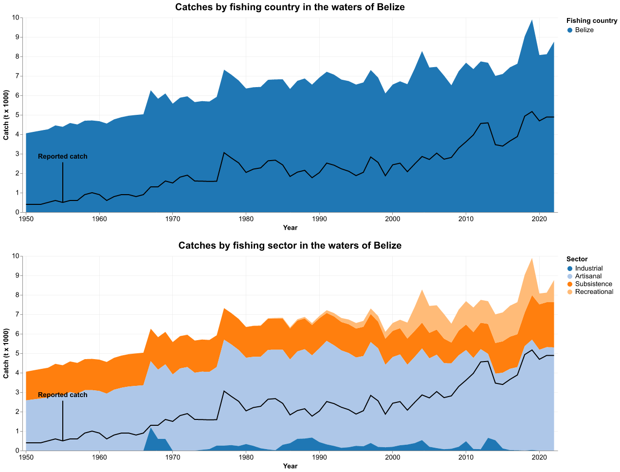
Preliminary results have now been published for 30 of the 283 Exclusive Economic Zones that make up our segmentation of the global ocean. The goal is to give our users a first glance at more recent trends and what the updated graphs will look like.
Updated data are available for:
- Bahamas
- Belize
- Bulgaria
- Cape Verde
- Chagos Archipelago (UK)
- Crete (Greece)
- Easter Isl. (Chile)
- Cuba
- Djibouti
- Greece (without Crete)
- Iceland
- India (mainland)
- Iraq
- Korea (North, Yellow Sea)
- Korea (North, Sea of Japan)
- Madeira Isl. (Portugal)
- Mauritius
- Mexico (Atlantic)
- Mexico (Pacific)
- Niue (New Zealand)
- Northern Marianas (USA)
- Senegal
- Seychelles
- South Georgia & Sandwich Isl. (UK)
- Sudan
- Tokelau (New Zealand)
- United Arab Emirates
- USA (East Coast)
- USA (Gulf of Mexico)
- Wake Isl. (USA)
To access the revised graphics, users can scroll down to the “More info – Preliminary Reconstruction Results (1950 – 2022)” section and click on “EEZ graph.” They will be taken to a new browser tab with static images showing catches by fishing country and catches by fishing sector.
The complete update of all countries and territories’ catches is expected to be available in 2026.