The following is a features essay written by Daniel Pauly in the most recent Save Our Seas Magazine. Below he describes the effects of industrial fishing on the oceans over the last 130 years — and how marine protected areas are needed to help conserve and restore what has been lost.
*********
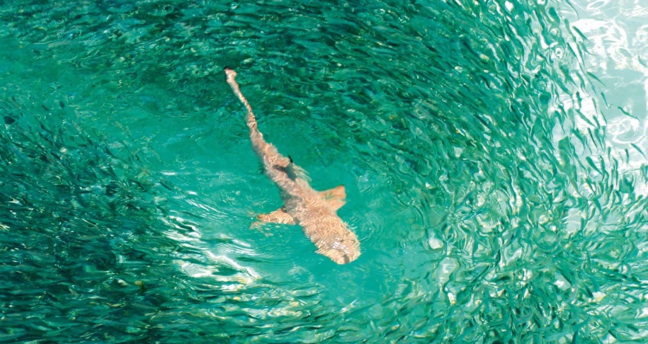
Feeding frenzy: whitetip reef shark feeding in the Maldives. The island nation declared its waters a sanctuary for sharks in 2010.
Photo by Mohamed Shareef | Getty Images
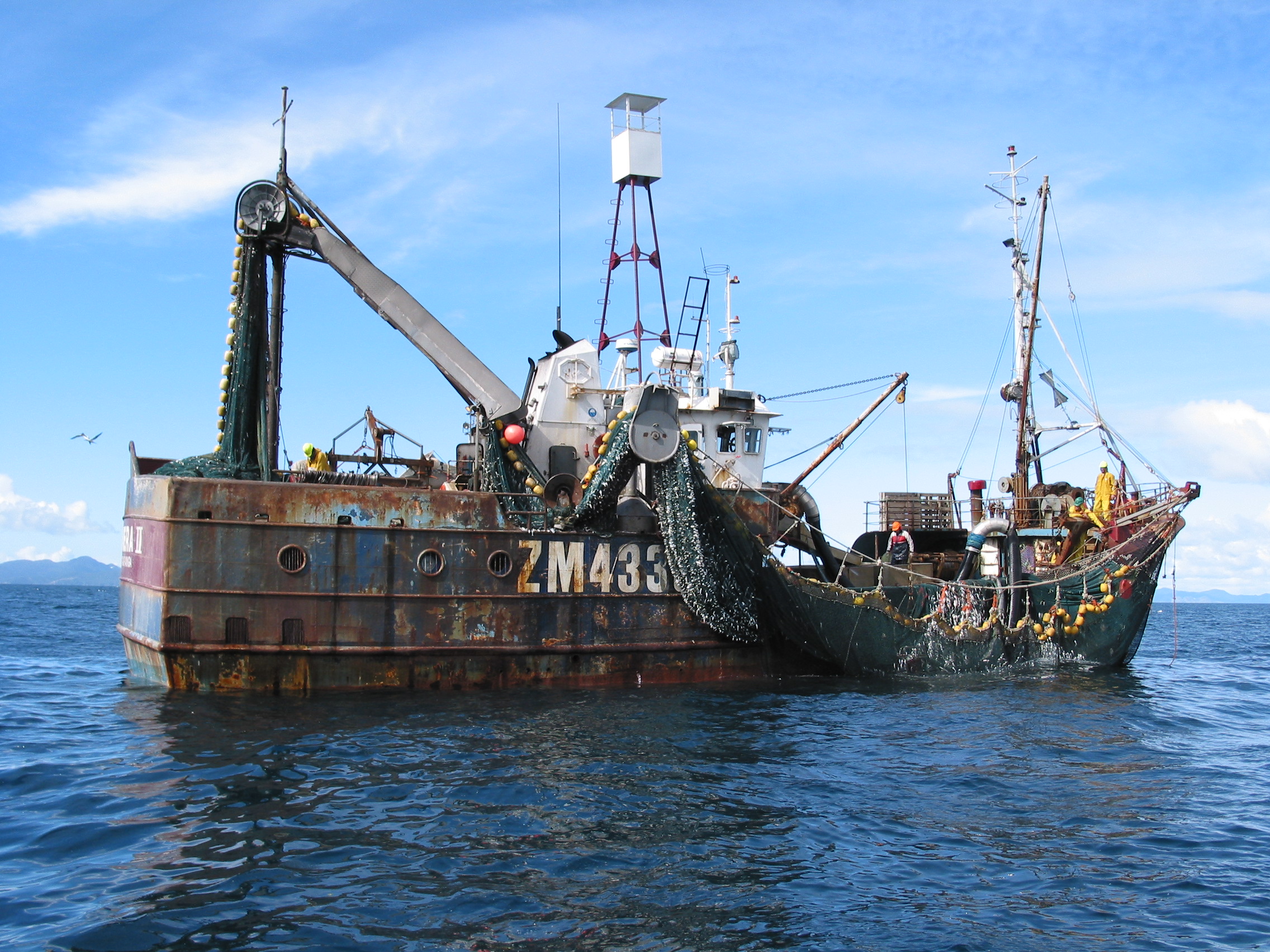
Industrial fishing began in the 1880s, when steam trawlers started to be deployed along the coasts of the British Isles. Frighteningly efficient, they soon liquidated coastal stocks of bottom fish – fish that had previously been exploited by subsistence and artisanal fisheries for centuries, even millennia, but had persisted.
The steam trawlers then had to expand their range into the open North and Irish seas and subsequently beyond, all the way into North Atlantic and Icelandic waters. The same expansion, but shifted a decade or so later, occurred with the nascent industrial fisheries of France, Germany, Russia, the United States and Japan. It’s a recurring pattern: the introduction of industrial fishing begets expansion because trawlers and other industrial fishing vessels (such as purse seiners) generate a pressure that generally cannot be tolerated by the species being targeted at a given fishing ground – and even less by the by-catch species, which are, by definition, subjected to unregulated fishing. Thus, one stock disappears after the other, and new stocks in previously unfished areas have to be found.
This depletion–expansion dynamic prevailed through much of the 20th century, albeit with the interruption of two world wars, which radically reduced industrial fishing and allowed fish to recover – if only temporarily – especially in the North Atlantic. In some areas, when this effect was strong, like in the North Sea, the recovery after a temporary reduction in fishing established the principle not only that stock abundance was inversely related to fishing intensity, but also that overfished stocks could recover, and some within a few years. In the last quarter of the 20th century, some countries, for example the US and Norway, built on this to counter the depletion–expansion dynamic of their fisheries. They allowed the stocks they had overexploited to rebuild, which the stocks did and now support vibrant ‘new’ fisheries.
In most other countries, however, the depletion–expansion dynamic continued. Thanks to their onboard technology, trawlers and other industrial vessels could fish anywhere in the world, in deep or shallow waters or far from coastlines, and in conditions from tropical to polar. These developments meant that previous obstacles to fishing – depth, distance, ice cover and inclement weather – could now be overcome. We could fish everywhere, anytime we wanted. And we did.
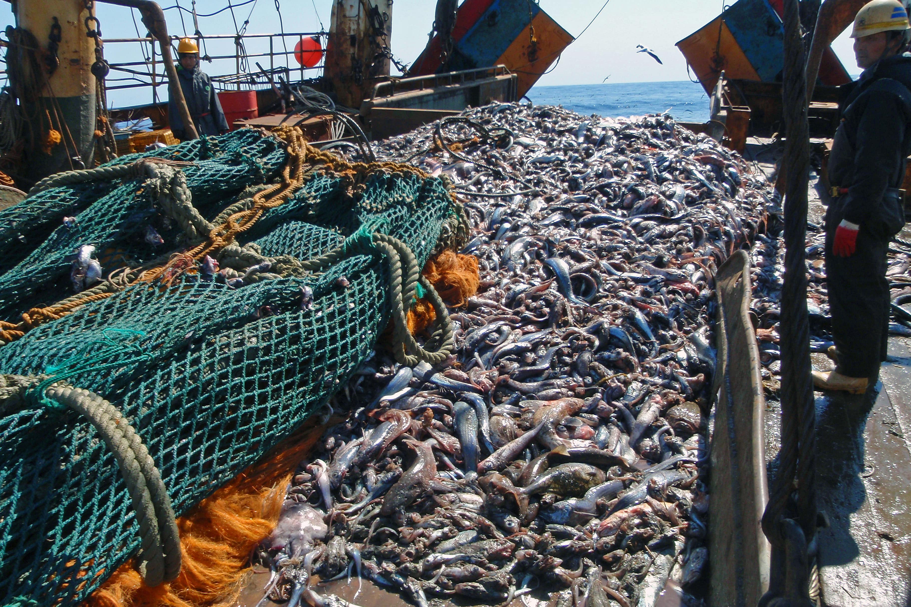
As a consequence, essentially all fish resources in the world are being fished. Given that most of the world’s fisheries are not managed (or that their management is so ineffectual as to be non-existent), this also means that fish with characteristics that render them more vulnerable to fishing than other species, or which are highly sought after, are increasingly under the threat of extinction. This is particularly well illustrated by the sawfishes (Pritis spp.), whose long, saw-like rostra get caught in any net they encounter; by the manta rays now hunted because of the alleged curative value of their gill plates; or by the many species of large sharks being decimated by targeted fishing, driven by the high commercial value of their fins, which are used for shark-fin soup.
These species cannot withstand any fishery that is anything but extremely well managed (which is rare), and they will thus thrive only in the few places where they are left alone. Such places are marine protected areas or, more precisely, no-take marine reserves. Moreover, in addition to sheltering the biodiversity that sawfishes, manta rays and large sharks represent, marine protected areas safeguard thousands of other species – and the ecosystems in which they are embedded – from the depredations of industrial fisheries that are driven by an increasingly out-of-control demand, especially from East Asia and the rich countries of Europe and North America.
That marine protected areas are effective in protecting marine life is amply demonstrated in the scientific literature: within them, biomass and biodiversity are higher and individual fishes are larger, thus producing more eggs and larvae that can enrich surrounding areas. This is not surprising. After all, fishing removes fish from the ecosystem; thus ceasing to fish, given time, should reverse its effects.
There are obviously a number of factors that intervene in the effectiveness of the protection afforded by marine protected areas, such as the degree to which the regulations protecting biodiversity are enforced, the size of the protected area and the fishing activity surrounding the protected area. Nevertheless, the principle holds that marine protected areas, and especially no-take marine reserves, are our best defence against the depletion–expansion dynamic that characterises industrial fisheries, especially now that they are operating in all ocean areas.
It is thus encouraging that the fraction of the oceans that was protected by a motley collection of small, often ineffective marine protected areas, and whose growth had long been anaemic, has increased massively in recent years. This occurred through the creation of very large marine reserves around uninhabited islands in the Pacific and Indian oceans. The constructive example that these reserves provided has even jump-started a debate about the feasibility of protecting the High Seas, or at least some parts of the oceans currently beyond national jurisdiction, which we must do if they are not to be transformed to a seascape with more plastic than fish.
The original article can be viewed here.
![SardinesCloseup[Crop]](http://www.seaaroundus.org/wp-content/uploads/2016/05/SardinesCloseupCrop.jpg)