The Sea Around Us Catch Allocation Map is an interactive tool that allows users to view global catch using different parameters, like country, year, functional or commercial group, and taxa, from 1950 until 2010. Two or more countries can also be viewed at the same time.
The embedded video is a short and concise guide on how to use the tool.
Click here to try the tool out yourself.
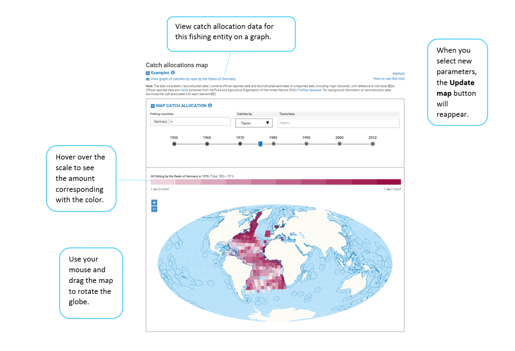
And if you have further questions as to how it works, click here for more information. You will find diagrams like the one below that are complimentary to the video.
Follow us on Facebook and Twitter for more updates!